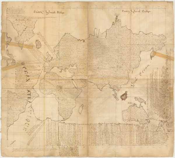
GarinMap
From Marist Studies
Revision as of 11:04, 30 December 2016 by Merv (talk | contribs) (Created page with "==Father Antoine Garin. Map of the World, 1840-1, Letter to his parents== ''Translated by Fr Brian Quin SM. (Not all the annotations are included in this translation)'' I...")
Father Antoine Garin. Map of the World, 1840-1, Letter to his parents
Translated by Fr Brian Quin SM. (Not all the annotations are included in this translation)
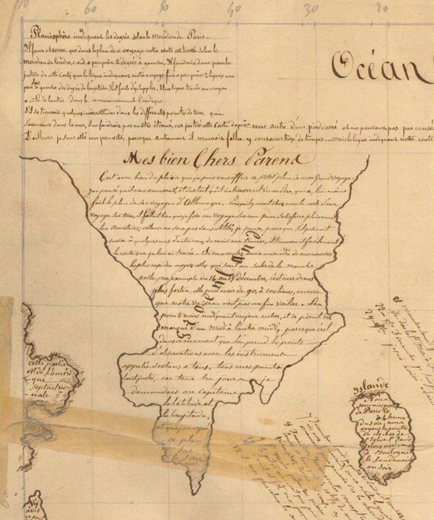
- [Greenland]
- Planisphere indicating the degrees according to the Paris meridian. It must be realized on the map of the voyage the route we took is drawn according to the London meridian, i.e. about 2 degrees to the left. So for the map to be correct, the line showing our route would have to be 2 lines further left of the degrees of longitude. It’s easy enough to make the adjustment. A pencil line next to the other one at the beginning shows where it should go.
If there are some inaccuracies in the different promontories that extend into the sea, don't be surprised, as I draw this map from another that was only one foot square and so I couldn’t depict these precisely. And I did draw if fairly quickly, because otherwise I’d have had to spend too much time on it. But the line indicating our route is accurate.
- My dearest parents
- It's a great pleasure to me to send you this little map of my big trip. I thought you would like it and that my father would be particularly interested in it, as he did a map of where he went in Germany. Because we had a map at our place of a land journey, I had to make a sea voyage if I was to please the connoisseurs. This map could even be useful, in my opinion, as, if any of you wanted to come and find me, they could easily follow the route I've shown. If you want to have an idea of the fastest sections of our voyage, look at the ones as we were leaving the English Channel, the one for the 14 to 15th December, for example. It is one of our best, around 90 or 100 leagues, even though our ship is no fast clipper. The little black circles mark off the days. They go from midday to midday, because that is when our position is established with instruments called T-sextants. All these are correctly positioned as I asked the captain our latitude and longitude every day and I copied my map from his.
- [Iceland]
We left Paris on the [blank] at 4.p.m. We saw the tops of the steeple of the St Denis church. We arrived at Boulogne the evening of the following day.

